
Satellite data in the AFDRS
The Australian Fire Danger Rating System uses satellite data to estimate grassland curing across the landscape. Satellite information does not replace local knowledge. Instead, it provides an important evidence base that is combined with field observations and expert judgement to produce the most accurate representation of grassland curing.
What is satellite data?
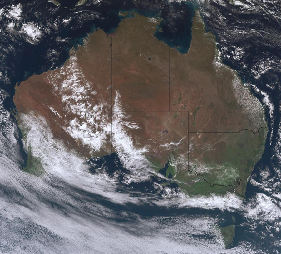
Satellites orbiting the Earth collect information about vegetation, moisture and land surface conditions. This information allows fire and land management agencies to monitor vegetation across vast areas of Australia, including remote locations where on-ground observations may be limited.
The Australian Fire Danger Rating System (AFDRS) uses satellite data to estimate grassland curing across the landscape. Satellite information does not replace local knowledge. Instead, it provides an important evidence base that is combined with field observations and expert judgement to produce the most accurate representation of grassland curing.
How does the AFDRS make curing data?
Satellite-derived curing data provides consistent, nationalscale information about changing grass conditions. The Bureau of Meteorology processes the data each day for use in the AFDRS. More information about how satellites provide information for Australia’s weather services can be found on the Bureau of Meteorology website.
The AFDRS Fuel State Editor Observer (FSE) App enables observers from fire and land management agencies across Australia to record grass fuel observations of curing, load and condition directly in the field, supporting more accurate and timely fire danger assessments. Released for Android and Apple devices in March 2025, the app allows observations to be captured even in areas with limited or no connectivity, with data automatically uploaded once an internet connection becomes available. This improves the efficiency and accessibility of fuel monitoring, particularly in remote and regional locations.
Across Australia, ground-based curing observations are combined with satellite-derived curing estimates through the Victorian Improved Satellite Curing Algorithm (VISCA), developed by the Victorian Country Fire Authority (CFA)1. Western Australia (WA), operational curing data are derived from a modified version of VISCA and a satellite model named MapC- Landgate. Within the Fuel State Editor (FSE), satellite estimates can be reviewed alongside field observations and local expertise, allowing jurisdictions to adjust curing assessments where local conditions differ from satellite estimates or where satellite coverage has limitations.
Why is grassland curing important?
Grassland curing is the percentage of grass that has dried or died. Green grass contains moisture and is generally less available to burn. As grass cures, it becomes drier, ignites more readily and can support faster-moving and more intense fires.
Grassland curing can change week by week, so accurate and timely curing information is critical for understanding grass fire danger. Further information can be found in the CFA Grassland Curing Guide and Grassland Curing Field Card.
Transitioning satellites
The AFDRS is changing satellites from the MODIS sensor to data derived from the newer VIIRS sensor. This transition maintains the national satellite curing capability as the Terra satellite, which carries MODIS, continues to age and is retired.
What is the difference?
MODIS -
- Operates aboard NASA’s Terra satellite, launched in 1999, and Aqua satellite, launched in 2002.
- Terra has supported operational grassland curing products since 2013.
- Terra has exceeded its original mission life and its orbit has been lowered.
- Terra passes over Australia in the morning.
VIIRS -
- Operates aboard three satellites: 1. Suomi-NPP, 2. NOAA-20, 3. NOAA-21, with NOAA-21 data planned for incorporation in late 2026.
- Provides measurements designed to be comparable to MODIS and adjusted to maintain consistency with the existing curing product.
- Passes over Australia in the afternoon, and therefore affected by afternoon cloud cover.
- Supports continuity of satellite observations into the 2030’s and beyond.
- VIIRS curing is lower than MODIS curing (up to 2.6% difference in Northern sites and 1.4% in Southern sites), except for the Winter months in Southeastern Australia, where VIIRS curing is higher than MODIS1.
Both products provide curing estimates at approximately 500-metre resolution. Because the MODIS and VIIRS sensors measure vegetation slightly differently, researchers from Victoria CFA and the BoM have adjusted the processing of VIIRS
data to maintain consistency with the existing MODIS based curing product and continuity for operational fire danger calculations1.
What does the change mean operaionally?
For most users, the change will be incorporated into existing AFDRS processes. Fire and land management staff should continue to:
- review curing information alongside local conditions and observations
- check the age of satellite observations, particularly following extended cloud cover
- provide field observations where satellite data appears older or does not represent local conditions
- use the Fuel State Editor to review and, where appropriate, refine candidate curing information.
Continuous improvement
The transition to VIIRS demonstrates the AFDRS commitment to maintaining a scientifically robust, operationally reliable and sustainable national system.
As part of this work, the Fuel State Editor has been enhanced to show the age of satellite observations. This allows editors to identify locations where observations may be older and target field checks where they will provide the greatest value. Future improvements may also combine data from multiple satellites to strengthen spatial and temporal coverage.
1. Wright D and Majewski L (2023) International Journal of Wildland Fire 32 (10), 1438–1454. https://doi.org/10.1071/WF22227
For more information, access the 'Grassland curing: The science behind grassland fires' interactive story on the CFA wesbite or watch CFA's YouTube video 'Satellites: data from space (Grassland curing)'. In this video, satellite expert Danielle Martin explains her work in the grassland curing project.
Attachments: